Western Washington has entered a “historic” flooding crisis that has forced tens of thousands of residents to leave their homes and could displace even more as rivers reach record levels.
Record Flooding Across Western Washington
The Skagit River, a key waterway in the region, climbed to 37.7 feet overnight, well above the 28‑foot threshold that signals a flood event. The National Weather Service warned that the river would cause severe or record flooding from Sedro‑Woolley to Mount Vernon.
Other rivers also reached record crests. The Snohomish River in Snohomish, the Cedar River in Renton, the Nooksack River in North Cedarville, and the Grays River in Rosburg all reported unprecedented peaks, according to an NBC News analysis.
As of Friday morning, the water level in the Skagit began to slow its rise, but the flood risk remained high. The National Weather Service stated that “major to catastrophic flooding effects are likely to continue for several days across portions of western Washington State and northwestern Oregon.”
The flood watches covered about 5 million people across western Washington, as reported by an NBC News analysis, underscoring the scale of the emergency.
Emergency Measures and Evacuations
Washington Governor Bob Ferguson issued an emergency declaration with the approval of President Donald Trump. In a statement, Ferguson said he had received a phone call from Secretary of Homeland Security Kristi Noem, who informed him that the president had signed the state’s request. He added that the state had also received written confirmation of the emergency declaration and thanked Noem on behalf of Washington residents.
Ferguson warned that “tens of thousands of Washingtonians could face orders or warnings on Friday as the flooding moves into more densely populated areas.” He later told CNN that he was concerned about reports of people returning to homes along the Skagit after rainfall stopped, adding, “Our message is the river is literally going to reach historic levels on the Skagit River near towns like Burlington and Sedro‑Woolley. As long as we’ve been recording the river, it’s never gone this high in those areas.”
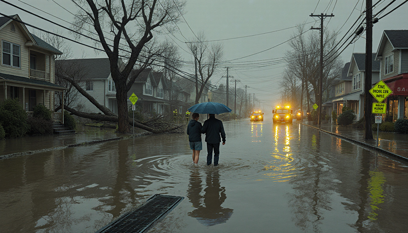
On Thursday, a county order told about 100,000 people living in the 100‑year Skagit River flood plain to “leave now.” Ferguson said most residents had complied, but the danger remained and more areas faced flooding on Friday.
Near the Canadian border, the cities of Sumas, Nooksack and Everson were also evacuated. Sumas Mayor Bruce Bosch described the damage as “devastated,” comparable to flooding four years earlier. He noted that the full extent would only become clear when the water receded.
In the afternoon of Friday, Skagit County posted on Facebook that “ALL RESIDENTS IN THE CITY OF BURLINGTON SHOULD EVACUATE IMMEDIATELY.” Local officials added that the National Guard was going door‑to‑door to notify residents and help evacuate.
Helicopters rescued two families on Thursday from roofs of properties in Sumas that had been flooded by about 15 feet of water. Frank Cain Jr., battalion chief for Whatcom County Fire District 14, told The Associated Press that two houses in nearby Welcome collapsed and were washed into the Nooksack River.
The Whatcom County Sheriff’s Office, covering Sumas, said it would patrol to prevent lawlessness and warned would‑be looters that they would be booked into the county jail. The National Guard released an image of troops rescuing a person from the roof of a vehicle in Skagit County on Thursday, one of several rescues across the region.
Impact on Communities and Infrastructure
Central Pierce Fire & Rescue shared a video showing first responders in inflatable boats in Puyallup, along with a plea for motorists to avoid flooded areas: “Turn around, don’t drown.” The weather service issued a string of warnings: “Even 6 inches of fast‑moving flood water can knock you off your feet and a depth of 2 feet will float your car. Never try to walk, swim, or drive through such swift water. If you come upon flood waters, stop, turn around and go another way.”
Road closures were widespread. Large parts of State Route 40 were blocked, and a landslide blocked Interstate 90 east of Seattle. These disruptions compounded the already‑challenging evacuation efforts.
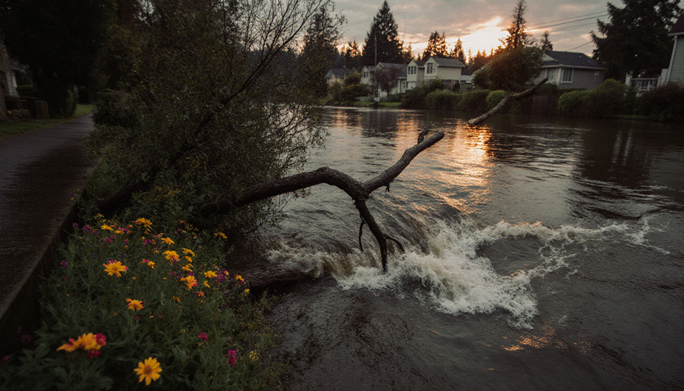
The floods dealt a brutal blow to a region still recovering from the heavy floods of 2021, adding another layer of hardship for residents and emergency services.
Climate Context and Future Outlook
New research, alongside studies from NASA and NOAA, shows a clear link between climate change and more intense atmospheric rivers. The storms that flow off the Pacific Ocean are becoming increasingly wet, triggering more frequent flooding as the planet warms. National climate reporter Chase Cain explained how climate change is making atmospheric rivers more hazardous.
While drier weather is on the way, the weather service cautioned that “major to catastrophic flooding effects are likely to continue for several days across portions of western Washington State and northwestern Oregon.”
More than a foot of rain fell across parts of Washington state in the last 72 hours, contributing to the record river levels.
Key Takeaways
- The Skagit River peaked at 37.7 ft, well above the 28‑ft flood threshold, while other rivers also hit record crests.
- Governor Ferguson issued an emergency declaration with President Trump’s approval, and the state ordered evacuations for about 100,000 residents.
- National Guard, helicopters, and local first responders conducted rescues, while major roads and interstate routes were blocked.
The ongoing floods underscore the region’s vulnerability to extreme weather events and the urgent need for coordinated emergency responses.
Closing
Western Washington’s flood crisis has tested the resilience of communities, emergency services, and infrastructure. With record river levels, widespread evacuations, and significant damage, the region faces a challenging recovery ahead. Authorities continue to monitor conditions and urge residents to stay alert as the weather evolves.