
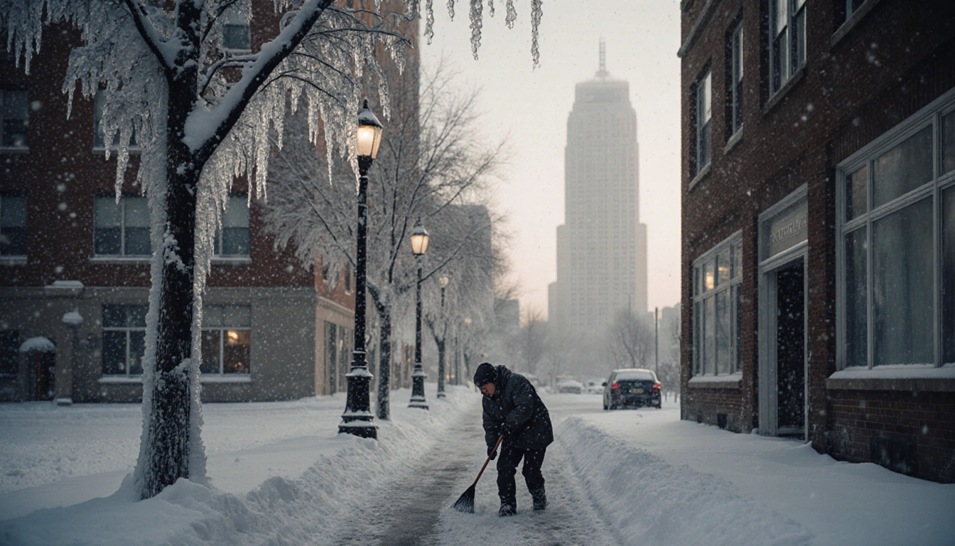
Philadelphia residents are preparing for a light snowstorm this weekend, followed by a sharp drop in temperatures that could make roads slick. A fast-moving Alberta clipper is expected to bring 2‑3 inches of snow and bring temperatures into the teens. The forecast warns that any leftover snow will freeze quickly, turning sidewalks into slick surfaces, and the city urges residents to clear driveways.
First Alert is in effect for the entire region Saturday night through Sunday morning, according to the local weather service. The alert signals that conditions may become hazardous as the snow and cold arrive. Residents should stay informed and heed the warnings.
Clipper Forecast
The Alberta clipper will arrive late Saturday, Dec. 13, and is moving fast across the area. Clouds will increase over the region, and daytime temperatures will be in the lower 40s. The clipper brings a small amount of moisture but enough to produce a widespread, accumulating snowfall as it heads into Sunday. Because clippers typically bring little moisture, the precipitation will be concentrated.
Snow Details
Snow or a wintry mix is expected to begin falling early Saturday evening around 6 p.m. as the clipper moves in. The precipitation will start as rain after 6 p.m. and transition into steady snow between 8 p.m. and 10 p.m. Widespread, steady snow will continue from 11 p.m. through 5 a.m. The accumulation is expected to be fluffy, making it easier to clear once temperatures rise. The brief snowfall will likely leave a thin, fluffy layer that can be cleared with a shovel or broom.
Lingering snow showers will affect the Jersey Shore until 8 a.m., while the snow will end along the Interstate 95 corridor between 4 a.m. and 6 a.m. The snowfall will continue overnight before tapering off early Sunday morning around 6 a.m. Preliminary data indicates about two to three inches of fluffy accumulation.
Aftermath and Cold

By late Sunday morning the snow will have melted or been cleared, but frigid air will follow the system. Temperatures will drop through the afternoon and into Sunday night, falling into the teens. Any snow left on driveways, sidewalks, or roads that is not shoveled will freeze solid and become slippery quickly. The rapid drop into the teens will likely cause any remaining snow to freeze, turning the surface into a hazardous slick. The sudden temperature plunge will also make the roads slick even after the snow has melted.
Impact on the Eagles Game
The cold may play a significant role in the Eagles’ Sunday afternoon game. Gusty winds will make it feel like it is in the teens during the game. Players and fans should be prepared for the chilly conditions. The chilly conditions could affect player performance and fan comfort. The wind chill may further lower perceived temperatures, making the game environment feel colder than the actual air temperature.
Monday Morning Outlook
On Monday morning, temperatures are expected to drop into the teens again, providing a frigid start to the work week. The forecast continues to emphasize the importance of staying warm and cautious on the roads. Drivers should be especially cautious during the early hours when the roads are most likely to be slick. Drivers are advised to allow extra time for travel and to check for road closures before heading out.
Importance of the Clipper Path
The path the clipper takes is crucial for determining the exact snow totals. Sunday’s snow amounts may shift as forecasters fine‑tune the model. Confidence is growing that the region will wake up to a fresh layer of powder early Sunday morning. Because the clipper moves quickly, the snowfall will be concentrated in a short period, making it challenging to clear in time. Because the clipper moves quickly, forecasters must monitor its trajectory closely to predict the exact snowfall distribution.
Staying Updated
For the latest updates on the upcoming snow and brutal cold, residents can download the NBC10 app. Following the NBC10 First Alert Weather team will provide real‑time information. The NBC10 app provides real‑time alerts and updates on precipitation and temperature changes. The app also offers push notifications that alert users when conditions change.
Key Takeaways
- Light snow of 2‑3 inches expected over the weekend.
- Temperatures will fall into the teens, creating slippery conditions.
- The Eagles’ Sunday game will be played in cold, gusty winds.
- Stay updated via the NBC10 app and First Alert Weather team for timely information.
Residents should clear driveways, watch for frozen sidewalks, and keep an eye on weather alerts throughout the weekend. The forecast warns of rapid freezing of any remaining snow, increasing the risk of accidents. Preparedness and vigilance will help keep the community safe. Residents who clear snow early can reduce the risk of accidents as the temperatures drop.
With a fast‑moving clipper, light snowfall, and a sharp temperature drop, Philadelphia’s residents must stay alert and take precautions. The city’s First Alert Weather team urges everyone to stay informed and ready for the coming cold snap. The weekend’s weather will test the city’s readiness for icy conditions. The weather service will continue to monitoring the situation closely and update forecasts as new data arrives.